• Fairfax Park

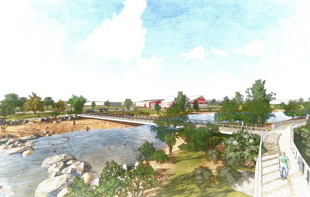
    This public urban pocket park was constructed in the middle of a redeveloped mixed-use, higher density block. Features in the park were designed to meet the multi-generational needs of adjacent residents based on an extensive public engagement process. Park amenities will include a splash pad, custom shade structures, and a unique urban play structure centered in the park. Surface drainage and runoff will be filtered through a bioretention planter medium before being released to downstream storm drains. The University of Colorado Denver partnered with Logan Simpson to prepare baseline data that can be used to measure the performance of the park after its construction.

  • Summit County Open Space Plan and Comprehensive Plan

    Logan Simpson prepared the first update of the Summit County Open Space & Trails Master Plan since 1996. The previous Plan focused on land acquisition for a newly conceived program; the new Plan guides the acquisition, trail development, maintenance, and resource management into the next decade to proactively address challenges and adapt to change. It provides policy guidance on open space, trails, and other outdoor recreation topics across jurisdictional boundaries. This Plan works with the Countywide and Basin Master Plans to reflect the community’s vision for open space and trails throughout the County. It is focused on non-developed, nature-based recreation and provides guidance to federal, state, and local agencies that collaborate with Summit County, with each able to set its own policy on lands under their respective jurisdiction. The planning process integrated partners, land managers, resource interests, and recreation stakeholders to address acquisition, stewardship, and visitor priorities. Multi-lingual in-person and online public input was a driving force in the development of this Plan.

  • Navigating Farmington’s Future Comprehensive Plan

    Logan Simpson completed an update to the City of Farmington, New Mexico’s 2002 Comprehensive Plan to reflect the City’s transformation from an economy traditionally reliant on oil, gas, and coal extraction, to one that is much more diverse. Policies within the draft plan highlight an economic future that strengthens key assets such as: outdoor recreation opportunities; a burgeoning film industry; and access to regional healthcare and higher-level education; increased tourism; and becoming an active lifestyle destination for its influx of retirees. The Plan provides recommendations to assist Farmington’s governing bodies in decision-making, moving policy and development forward in a productive way conducive to transforming Farmington into a healthy, sustainable economy. The Plan is reflective of public outreach efforts by integrating what residents and business owners love and the issues they identify. Based on public input, the update includes new elements such as planning for healthy and socially sustainable communities, bicycle and pedestrian infrastructure, and environmental quality.

  • Buckeye Wildlife Corridors, Best Practices Guide

    Logan Simpson developed the first-of-its-kind Wildlife Corridors Best Practices Guide, a set of best management practices and tools for development that considers harmony with wildlife corridors and the natural environment within the City of Buckeye’s growth area. While much of land surrounding the City remains undeveloped and provides essential habitat for wildlife, Buckeye is evolving rapidly, and the population increase warrants thoughtful planning. With the goal of maintaining and enhancing existing biodiversity while ensuring community prosperity, a case study-based approach was taken to organize this Guide around three strands – environmental, growth, and quality of life. The Guide’s is to advocate for wildlife connectivity throughout the City and encourage collaboration between all groups involved in developing Buckeye. Groups and individuals with local expertise helped inform the planning process, including landowners/developers, utilities, local/state agencies, and conservation advocacy groups.

  • Frisco Bay Marina Master Plan

    Logan Simpson developed the vision and master plan for the Frisco Bay Marina on Lake Dillon. The plan, which was approved in July 2018, is a community-supported guide for the Town to implement components of the design as funding allows. Short- and long-term goals and implementable actions include making the park an extension of Main Street and addressing connectivity and access concerns around the waterfront. The marina’s capacity will be expanded to accommodate all types of boating, and recommendations were made to both activate and support year-round uses. In addition, actions were outlined to enhance and restore the ecology at the shoreline and overall site.

  • Lake Powell Pipeline Biological Resource Survey

    Logan Simpson completed biological resources technical studies for the proposed 225-mile Lake Powell Pipeline. The project included the construction and operation of a buried water pipeline, water intake facility at Lake Powell, surface water storage reservoirs, hydro-electric generation facilities, and transmission lines. The pipeline corridor included federal, state, private, and tribal lands extending from Glen Canyon Dam, Arizona to Cedar City, Utah. Logan Simpson: completed 386 miles of field surveys documenting 16 special-status plant species occurrences of over 350,000 plants; mapped the distribution of 17 species of noxious/invasive weeds; recorded 306 plant taxa; and documented 3,443 polygons representing 556 vegetation associations on 25,000 acres. As alignments shifted, we assessed which rare plants potentially occur and adjusted survey schedules to match phenology of the target plants in target areas to aid in surveys and positive identification. A geospatial database of the vegetation survey results was developed to provide the basis for impact analysis of rare plants, determine mitigation actions, and develop an invasive/noxious species management plan.

  • Utah Avocational – Identified Rock Imagery


    The Utah State Historic Preservation Office (SHPO) in conjunction with the Utah Rock Art Research Association (URARA) contracted with Logan Simpson in 2020 to conduct targeted archaeological site documentation at rock imagery locations on various land jurisdictions in Carbon, Sanpete, and Sevier Counties in central Utah. Project goals were to obtain baseline information of rock imagery sites to assist with management and interpretive efforts, prepare public products to increase awareness about fragile rock imagery, and incorporate volunteers. Logan Simpson coordinated with SHPO, land managers, and URARA to revisit GPS locations, update/record rock imagery sites to modern standards alongside URARA volunteers, and conduct on-site filming for use in a public video. The result was documentation of 18 newly recorded sites and updates for 53 previously recorded sites. The video features stunning aerial imagery, in-field interviews with archaeologists and volunteers, and centers on themes of preservation, stewardship, and public involvement in cultural resources management.

  • Uniquely Driggs Comprehensive Plan, Idaho

    Located between the Tetons and the Big Hole Mountains, Driggs has a thriving community of 1,800 residents. Logan Simpson developed a comprehensive plan update with a primary focus on health, with opportunities to improve health in the built environment integrated in to every element of the document. The boom and bust tourism economy has impacted Driggs since the 2008 recession, which led to several platted and unbuilt lots resulting in a housing shortage.  Logan Simpson and our team of consultants took a targeted approach to reviewing multiple housing program options to find solutions for workforce housing and supporting a balanced economy.

    As an inter-city airport, the land use component of the plan needed to take into account all of the ITD requirements in regard to crash and transition zones. Close coordination with the Driggs Airport Board was necessary to ensure compliance with applicable regulations, and to ensure continued operation and expansion of airport operations and associated industry, as residential uses continue to encroach upon the boundary. The Airport Master Plan was completed by the Board, and in tandem with the Comprehensive Plan in order to ensure consistency in these regulations and vision.

    Incorporation of health metrics and a focus on dedicated Hispanic outreach for the Uniquely Driggs Comprehensive Plan helped the project to win a 2020 Western Planner Rural Innovation Award. Outreach to minority communities were a focus of the plan. Through bilingual outreach materials, working with the Hispanic Resource Center, and meeting with middle and high school students, the project team proved to be highly successful in reaching the historically under-represented population.

    WINNER of the 2020 Western Planner – Rural Innovation Award

    The Plan highlighted the thoughtful housing approaches, pragmatic focus on infill, and sensitivity to critical habitats and neighboring jurisdictions. “It’s a plan that I will examine to provide ideas to other communities I work with and in addition I appreciate the thoughtful approaches for a beautiful place.” – Paul Mobley, AICP, PCED, The Western Planner

  • South of the River Subarea Plan

    The South of the River Subarea Plan presents a unique opportunity to support desired development patterns featuring a riverfront mixed-use activity center, surrounded by varied residential densities and connected by thoughtfully designed roads, trails, and paths. This detailed process includes a subarea plan and a detailed conceptual plan for a mixed-use activity center, vetted through stakeholder, and public engagement, traffic modelling, and floodplain analysis to ensure feasible and development that matches the intent and purpose of the subarea. The final plan will include a detailed subarea plan with illustrative sketches, visual simulations, and a strategic implementation guide. In addition, the Logan Simpson team will develop code overlay and text modification recommendations to ensure realization of the vision from the subarea plan.

    The subarea plan will provide a higher level of detail than the Com­prehensive Plan could, with specific detail for development at Star Road and along the Boise River in order to plan this area as the new downtown for Star.

  • Pagosa Springs Land Use Development Code Update

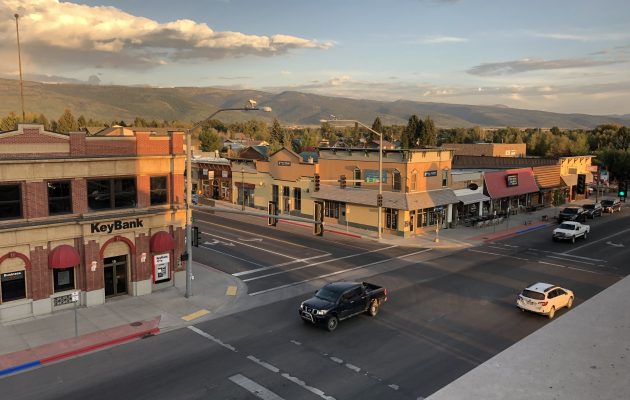
    The Logan Simpson team is working with the Town of Pagosa Springs to update the Pagosa Springs Land Use Development Code (LUDC). Pagosa Springs has experienced an uptick in growth over the past five years growing from approximately 1,800 residents in 2015 to 2,147 in 2020. With a well-established downtown, medical center, regional airstrip, outdoor recreation, and the popular hot springs, Pagosa Springs is quickly becoming a desirable place for people and businesses to establish. In order to continue to encourage development in a way that is respectful of the community vision as set forth in Pagosa Springs Forward, Comprehensive Plan, the current Land Use Development Code (LUDC) is being updated to streamline application processes and better address housing attainability, short term rental impacts, parking, environmental protections, and general design standards throughout the code. Additional topics up for discussion include stormwater management, solar priorities, electric vehicle charging, and low water landscaping.