• BLM Worland Field Office Travel Route Inventory

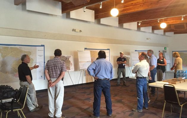
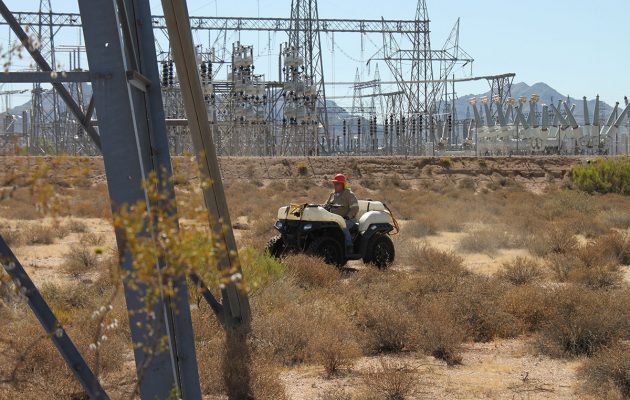
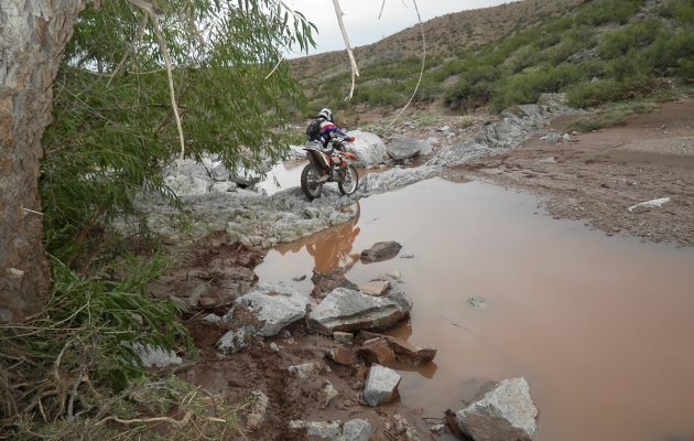
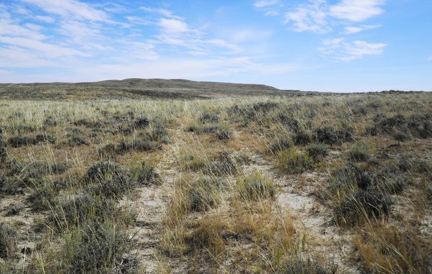
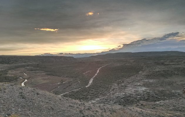
    Logan Simpson conducted route inventories of 3,429 miles and captured over 9,000 geotagged photos across 1,710,089 acres in the Worland Field Office in Wyoming. We used BLM’s GTLF standard in conjunction with a customized data dictionary. The inventory team maintained photos and track logs to document conditions and location of infrastructure such as campsites, signs, gates, unexpected trail terminations, etc. Inventory crews camped on BLM land during the inventory to avoid daily commuting, resulting in higher (inventoried) miles per day. This approach allowed the team to complete the project on budget and within the period of performance. Special consideration was given to the season in which inventory was conducted to ensure an accurate travel network was documented. Conducting the inventory around hunting season resulted in the documentation of routes that only have heavy use during that time of year.

  • Little Snake Route Evaluation, Travel Management Plan, and EA

    The BLM Little Snake Field Office route evaluation and travel management plan (TMP) is creating a new model for controversial transportation plans. Logan Simpson conducted evaluation, NEPA, and travel management planning tasks, including an EA, for 800 miles of roads, highways, and trails in the Hiawatha, Sand Wash, and Bears Ears travel planning areas in northwestern Colorado. The goal of the TMP is to create a travel network that is logical and sustainable, and also meets the increasingly diverse transportation, access, and recreational needs of the public. The EA analyzes the proposed plan and the alternatives that were considered during the planning process. Resources in the planning area include wildlife, cultural resources, grazing, energy and minerals, rights-of-way, paleontological resources, and recreation. We used Logan Simpson’s Travel Resource Analysis Model (TRAM) evaluation tool, which builds on the fundamental requirements set in the resource management plan to identify the benefits and risks associated with each route. TRAM allows NEPA data and guidance to be viewed in real time and creates an automatic administrative record of project details.


    We also used unconventional public involvement activities to engage stakeholders and cooperating agencies early in the planning process. We conducted public open houses inviting the public to engage early in the review of inventoried routes, evaluation criteria for route evaluation, identification of scoping issues, and review of proposed alternatives. We also used an online commenting tool allowing the public to comment on individual routes in addition to general comments on the travel system.


    Logan Simpson is following the streamlining guidelines contained in the Secretary of the Interior’s Executive Order 3355 as we develop the EA.

  • Arkansas Headwaters Recreation Area Management Plan Revision and EA

    Logan Simpson worked with the BLM (NEPA lead); Colorado Parks and Wildlife (management plan lead); and the US Forest Service (land manager) to update to the management plan and EA for the 150 miles Arkansas Headwaters Recreation Area (AHRA).  The AHRA is one of the nation’s most popular whitewater boating rivers and receives the highest level of commercial boating of any river in the nation. With 700,000 visitors annually, the AHRA is also popular for camping, wildlife watching, gold panning, and numerous other river-related recreation activities including its Gold Medal Trout Fishery. The challenge for the AHRA is to satisfy seemingly infinite recreational demands while at the same time maintaining both the environmental quality and the quality of visitor experiences along the river. The issue-driven management plan and EA addresses a wide array of topics, with a focus on carrying capacity, potential user conflicts, special activity and special use permitting, travel management updates for key areas, the need for new or improved facilities, and improved access and resource conservation. Logan Simpson led three rounds of public outreach to help guide the AHRA partnership in four different cities across the Front Range and in the project vicinity.

  • Transmission Line Herbicide EAs

    The Arizona Public Service Company (APS) and the Salt River Project Agricultural Improvement and Power District (SRP) are responsible for managing vegetation within their respective utility corridors in Arizona. To use integrated vegetation management more effectively, the Bureau of Land Management (BLM); the US Forest Service (USFS); APS; and SRP have agreed to consider using herbicide treatments alongside existing treatment methods within the authorized right-of-way corridors. Two EAs—one for the BLM, and one for USFS—are being prepared to analyze the potential impacts of using herbicides within the electrical distribution and transmission line corridors on BLM- and USFS-administered lands in Arizona. Logan Simpson was responsible for the project management, meeting facilitation, and coordination for the two separate EAs and associated processes. In addition to the meeting management, data management, and writing/editing the EAs, Logan Simpson is also responsible for managing the Forest Service project record, maintaining the file sharing system, and creating the project administrative file for USFS use.

  • BLM Johnson Hill Special Recreation Area Travel Management Inventory

    Logan Simpson completed 220 miles (7,647 acres) of route inventory within the BLM’s Socorro Field Office in New Mexico. The inventoried area included the Johnson Hill (Gordy’s Hill) Special Recreation Management Area and the Quebradas Backcountry Byway. Logan Simpson used the BLM’s GTLF standard in conjunction with a customized data dictionary. The inventory team captured over 1,000 geotagged photos to document route conditions and the location of infrastructure such as stock tanks, cattle grates, campsites, signs, gates, and other features in a landscape that contained very variable terrain that includes deep canyons, sand washes, high sandstone and limestone bluffs, terraces, and escarpments. The Johnson Hill Special Recreation Area is a popular OHV destination with challenging features and our inventory team was able to accomplish the work efficiently and safely. The BLM will use the GIS data and photos collected during the inventory as part of travel management planning.

  • BLM Lander Field Office Travel Management Inventory

    Logan Simpson conducted a route inventory of 5,259 miles for the Lander Field Office within the Agate Flats, Antelope Hills and Crooks Mountain Travel Management Areas in Wyoming. The project, which consists of 1,449,305 acres, was awarded under Logan Simpson’s BLM Travel Management BPA. The team used the BLM’s GTLF standard in conjunction with a customized data dictionary that included unique attributes requested by the field office, such as dominant vegetation type, noxious weed presence and the potential for off-track travel. The inventory team captured thousands of geotagged photos and photo points with over 70 domain choices for features such as route drainage, barrier or hazard, facility, resource, recreation use, and more to document route conditions and the location of infrastructure and other features of interest. The vast inventory area (roughly equivalent to the size of the state of Delaware) for this project was very remote and contained five wilderness study areas. To improve efficiency and minimize commute time our inventory team camped on site and moved our base camp as progress was made. This project received exceptional ratings from the agency in quality, schedule, cost control, management, and regulatory compliance.

  • Handbooks, Manuals, and Field Guides

    Logan Simpson has developed many manuals related to planning, design, construction, and maintenance of public facilities. We have also developed a variety of other technical, procedural, and program guidance documents, such as best management practices, field guides, decision-support tools, and training curricula. Our in-house staff includes technical writers and editors, graphic designers, and document development specialists who work with our landscape architects and other professional staff to translate complex technical requirements into easy-to-understand text. Depending on our client’s direction, we have produced detailed “cookbook”-style manuals that prescribe specific actions; guidance manuals that mix narrative with instructive graphics and images; and even manuals that rely heavily on interactive graphics as the primary gateway to the information the manual contains.