• Arkansas Headwaters Recreation Area Management Plan Revision and EA

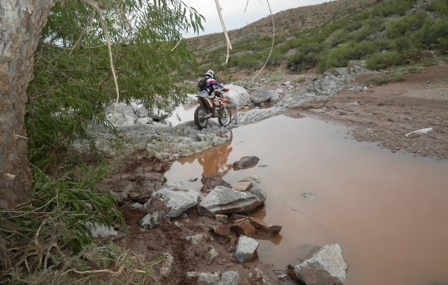
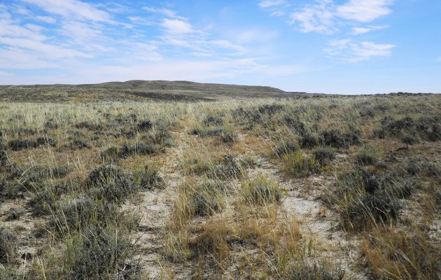
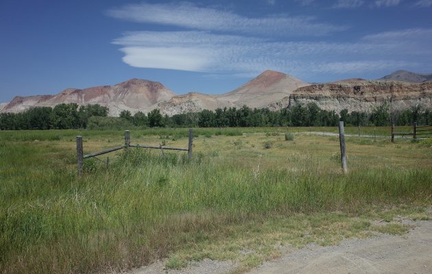
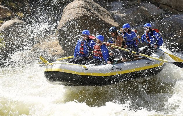
    Logan Simpson worked with the BLM (NEPA lead); Colorado Parks and Wildlife (management plan lead); and the US Forest Service (land manager) to update to the management plan and EA for the 150 miles Arkansas Headwaters Recreation Area (AHRA).  The AHRA is one of the nation’s most popular whitewater boating rivers and receives the highest level of commercial boating of any river in the nation. With 700,000 visitors annually, the AHRA is also popular for camping, wildlife watching, gold panning, and numerous other river-related recreation activities including its Gold Medal Trout Fishery. The challenge for the AHRA is to satisfy seemingly infinite recreational demands while at the same time maintaining both the environmental quality and the quality of visitor experiences along the river. The issue-driven management plan and EA addresses a wide array of topics, with a focus on carrying capacity, potential user conflicts, special activity and special use permitting, travel management updates for key areas, the need for new or improved facilities, and improved access and resource conservation. Logan Simpson led three rounds of public outreach to help guide the AHRA partnership in four different cities across the Front Range and in the project vicinity.

  • BLM Johnson Hill Special Recreation Area Travel Management Inventory

    Logan Simpson completed 220 miles (7,647 acres) of route inventory within the BLM’s Socorro Field Office in New Mexico. The inventoried area included the Johnson Hill (Gordy’s Hill) Special Recreation Management Area and the Quebradas Backcountry Byway. Logan Simpson used the BLM’s GTLF standard in conjunction with a customized data dictionary. The inventory team captured over 1,000 geotagged photos to document route conditions and the location of infrastructure such as stock tanks, cattle grates, campsites, signs, gates, and other features in a landscape that contained very variable terrain that includes deep canyons, sand washes, high sandstone and limestone bluffs, terraces, and escarpments. The Johnson Hill Special Recreation Area is a popular OHV destination with challenging features and our inventory team was able to accomplish the work efficiently and safely. The BLM will use the GIS data and photos collected during the inventory as part of travel management planning.

  • BLM Lander Field Office Travel Management Inventory

    Logan Simpson conducted a route inventory of 5,259 miles for the Lander Field Office within the Agate Flats, Antelope Hills and Crooks Mountain Travel Management Areas in Wyoming. The project, which consists of 1,449,305 acres, was awarded under Logan Simpson’s BLM Travel Management BPA. The team used the BLM’s GTLF standard in conjunction with a customized data dictionary that included unique attributes requested by the field office, such as dominant vegetation type, noxious weed presence and the potential for off-track travel. The inventory team captured thousands of geotagged photos and photo points with over 70 domain choices for features such as route drainage, barrier or hazard, facility, resource, recreation use, and more to document route conditions and the location of infrastructure and other features of interest. The vast inventory area (roughly equivalent to the size of the state of Delaware) for this project was very remote and contained five wilderness study areas. To improve efficiency and minimize commute time our inventory team camped on site and moved our base camp as progress was made. This project received exceptional ratings from the agency in quality, schedule, cost control, management, and regulatory compliance.

  • BLM Salmon and Challis Field Offices Visual Resource Inventories

    Logan Simpson is preparing two visual resource inventories (VRIs) encompassing approximately 5.9 million acres within the BLM’s Challis and Salmon field offices in Idaho. The project areas are nestled between the Bitterroot Mountains and the Continental Divide to the east and the Salmon River Mountain Range to the west. These BLM-managed lands hold some of the most ruggedly beautiful landscapes and notable natural and cultural resources in the state of Idaho.


    The VRIs document the scenic quality and visual sensitivity of the area’s outstanding visual, geological, historic, and prehistoric resources including the Jim McClure-Jerry Peak Wilderness Area, the Lewis and Clark National Historic Trail and Salmon River Special Recreation Management Areas, the Herd and Trail Creeks Areas of Critical Environmental Concern, and the Continental Divide National Scenic Trail. In addition to the Continental Divide National Scenic Trail, the project area also contains notable linear scenic platforms such as the Peaks to Craters Scenic Byway, Lewis and Clark Backcountry Byway, and the Sacajawea Historic Byway. The history-filled Sacajawea Historic Byway offers compelling views as well as a wealth of mining and Native American history.


    The project area also contains a portion of the longest free-flowing river in the contiguous United States—the Salmon River, which provides the public with exceptional recreation opportunities including whitewater kayaking, canoeing, rafting, and fishing. Tourism and recreation are major economic engines for the area’s small rural communities who place great significance on protecting historic vistas and special use areas.