• LiDAR Cultural Resources and Environmental Support

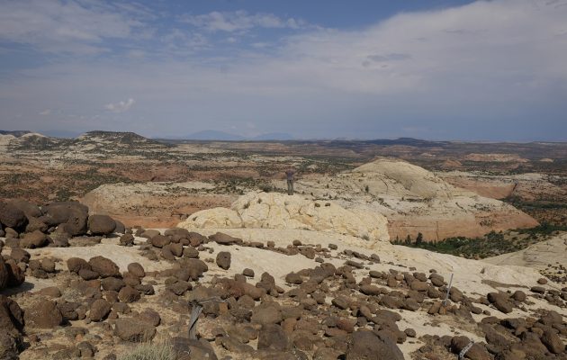
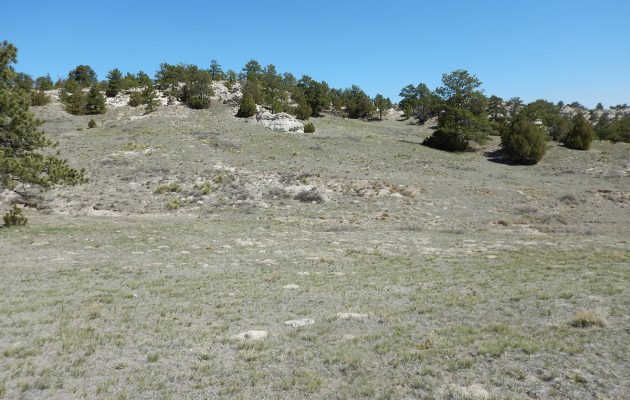
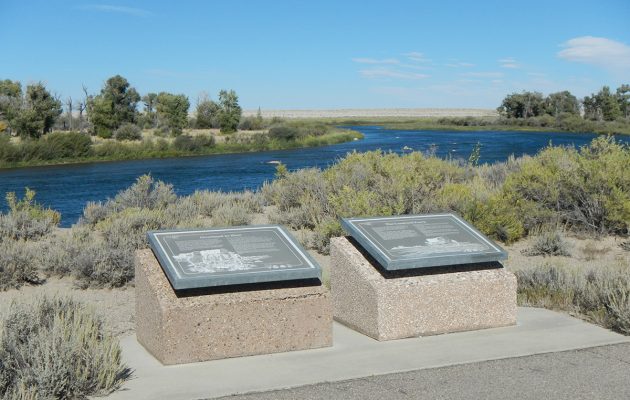
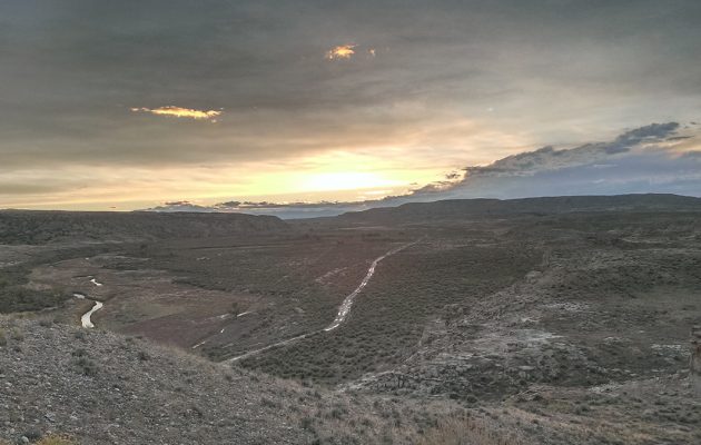
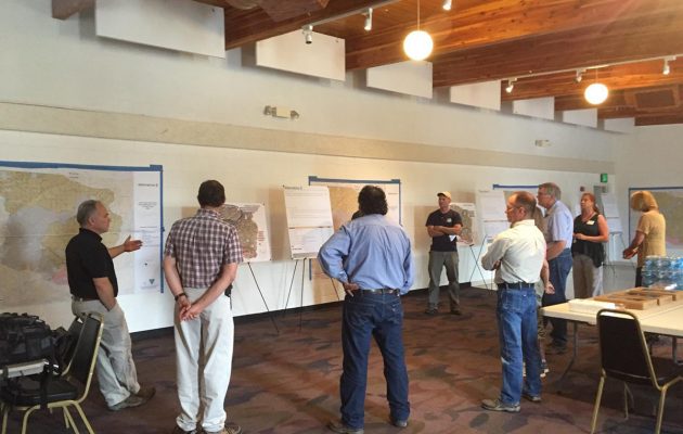
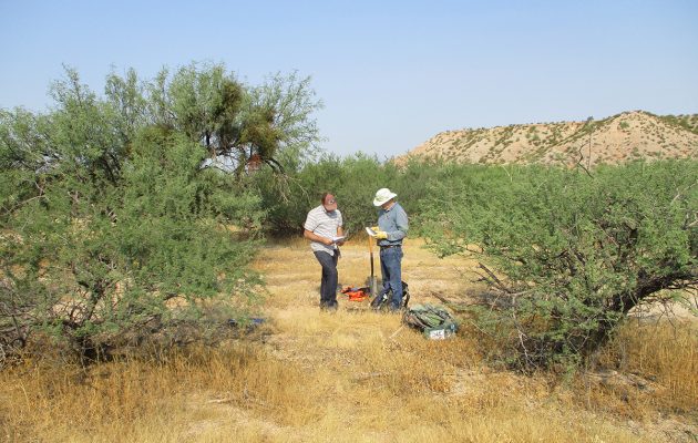
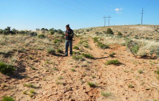
    Rocky Mountain Power uses Light Detection and Ranging (LiDAR) data collected from helicopter flights to measure minimum ground clearance, structural loads, wire sag, and wire tension along their existing electric transmission line network. Lines that pose a safety hazard are then repaired. Many of the lines pre-date environmental and cultural resources regulations such as NEPA, ESA, or NHPA. Logan Simpson helped Rocky Mountain Power navigate relevant regulations while ensuring that construction schedules were not impacted by unexpected environmental or cultural resources issues. Specific tasks included interfacing with federal and state agencies; large-scale literature reviews and due diligence studies to identify potential conflicts; GIS-based mapping, modeling, and database preparation; cultural resources inventories, site recording, and monitoring; and biological tasks like avian surveys, plant surveys, revegetation, and monitoring construction buffers for threatened and endangered species. We also identified construction access roads onto the right-of-way and facilitated the resolution of potential logistical issues that could impede construction.

  • NPS Transportation Resource Stewardship Protection Tool

    Logan Simpson is beginning Phase IV of this project, which provides a web-based decision-support system to allow NPS staff to manage natural resources within national parks. The tool allows users to aggregate and review natural resource data from multiple parks so trends can be identified. During Phase II, Logan Simpson piloted the program in ten parks in the Southeast Region. During Phase III, we improved the tool based on information gathered from interviews conducted with NPS technical specialists. The pilot testing for this phase was conducted in the Alaska Region and included nine national parks, two national forests, three national wildlife refuges, and BLM’s Eastern Recreational Management Area. In Phase IV, Logan Simpson will update the tool; update/develop support resources; and pilot the tool in the Intermountain Region.

  • Grand Staircase Escalante National Monument Visual Resource Inventory

    Logan Simpson is currently working on the final phase of the visual resource inventory (VRI) for the Grand Staircase Escalante National Monument (GSENM), located in south-central Utah. This VRI spans a study area of just less than two million acres, including all public lands with the prior GSENM boundary, as well as almost 40,000 acres of the Kanab Field Office that are located north of the monument’s boundary. The study area includes much of the Escalante River and Paria River watershed, segments of Scenic Byway 12 (Utah’s only All-American Road) and many miles of state scenic byways and back ways. It also encompasses 16 wilderness study areas, 252 miles of suitable wild and scenic river segments, and significant archaeological and historic sites, including a segment of the Old Spanish National Historic Trail, Dance Hall Rock National Historic Site, and the Hole in the Rock State Historic Trail.


  • Visual Resource Inventory of National Historic Trail Segments

    Logan Simpson provided a field inventory program for the Wyoming Military Department that assessed the trail segment and viewshed conditions of approximately 26 miles of the California, Oregon, Mormon Pioneer, and Pony Express National Historic Trails (NHTs) within the administrative bounds of Camp Guernsey, located in eastern Wyoming. The results of this assessment were then carried into NRHP eligibility recommendations for each trail segment. The site condition assessments included detailed in-field archaeological documentation of the disturbances to the trails. Archaeological documentation included inventory, measurements, photographs, and GPS-based mapping; this new data was compared to previously documented trail segments to determine the current condition of the trail sites. In addition, Logan Simpson prepared an archaeological report documenting the history, locations, and current integrity of the trail segments, as well as OAHP site forms. Logan Simpson provided a robust GIS data set of inventory components as well as supporting documentation associated with visual resources, NHT condition assessments by segment, and NRHP eligibility recommendations.

  • BLM Missoula Field Office Visual Resource Inventory

    Logan Simpson completed a visual resource inventory (VRI) for the BLM’s Missoula Field Office encompassing the highly scenic landscapes of western Montana. This inventory area covers nearly 14 million acres, including the Bitterroot Valley and Mountains, Flathead Lake, and Bob Marshall and Scape Goat Wildernesses. The inventory also abuts the world-renowned scenery of Glacier National Park, and includes viewsheds shared by the park. The inventory data will be considered as baseline information as the field office embarks on the development of its resource management plan. Research and public outreach for this project revealed numerous planning documents aimed at protecting scenery and scenic viewsheds—reinforcing the importance that users place on the area’s visual resources. This information was taken into consideration during visual sensitivity ratings, and resulted in well-informed and accurate delineations of differing sensitivities within the field office. Based on the varying topographic features, common presence of water, and variety of vegetation and colors, this inventory has revealed the largest percentage of Class A scenery of any of the VRIs we have completed to date. Vertical mountain ranges, scenic lowlands, large lakes, clear flowing water, and lush vegetation lend to the distinct character of these landscapes, much of which appears as it did when original inhabitants, explorers, and early settlers crossed these lands. The National Historic Trail (NHT) visibility analyses for the Lewis and Clark NHT and Nez Perce NHT that we completed provided additional information for consideration in management of the historic travel that add to the history of the area.

  • Rio Grande del Norte National Monument Visual Resource Inventory

    Logan Simpson completed a visual resource inventory (VRI) for the Rio Grande del Norte National Monument within the BLM’s Taos Field Office in Northern New Mexico. Located within the Taos Plateau geographic formation, the Monument contains varied resources—from numerous natural and geologic resources to abundant heritage and cultural resources. The inventory area covers approximately 310,524 acres of land, approximately 78 percent of which are managed by the BLM. This inventory is currently serving as the baseline visual conditions for considering management of visual resources in land management decisions for the Rio Grande del Norte National Monument Resource Management Plan that is currently under way. This project is unique due to outreach efforts associated with the sensitivity component of the VRI, which included coordination with local tribes to address culturally sensitive landscapes associated with the inventory area.

    The inventory area contains a wide variety of scenic landscapes that have geologically and topographically diverse features, such as distinctive volcanic cinder cone mountains; scenic river canyons; rolling hills; and broad, expansive plains and diverse vegetation such as grassland steppe, riparian, and forested types. Prominent scenic areas within the Monument include the Rio Grande Gorge—which includes the Rio Grande National Wild and Scenic River, Red River Wild and Scenic River, and the Rio Grande Gorge Bridge (High Bridge); the Wild Rivers Zone of the Rio Grande Gorge Special Recreation Management Area; the Taos Valley Overlook; and the Wild Rivers Backcountry Byway.

  • National Historic Trail Interpretive Assessments

    The BLM Wyoming State Office is developing conceptual guidelines to improve how BLM manages interpretive sites and overall visitor services along the California, Oregon, Mormon Pioneer, and Pony Express National Historic Trails (NHTs). Most NHT interpretive sites in Wyoming were developed in the 1970s and 1980s and are largely in a state of disrepair. Logan Simpson prepared site concept and interpretive sign plans for 28 BLM historic sites to assist in protecting cultural resources, improving site stewardship and motorized use, and user behavior with appropriate levels of public access. BLM Wyoming’s NHT visitor use and interpretive guidelines report will improve outdated facilities, accessibility, brand conformity, and interpretive effectiveness. The research and guidance on visitor profiles and outcomes, and shared goals with external partners will assist with visitor use planning. BLM Guidelines for the Quality Built Environment were implemented for the 28 sites, which in combination with an inventory and project record will streamline preparation of subsequent NEPA compliance.


    For the first time in the history of the National Trails System Act, a statewide and trail-wide Recreation Opportunity Spectrum (ROS) inventory characterizes the physical, social and operational components of Wyoming’s NHT visitor services. The ROS inventory of specific recreational setting characteristics and desired experiences is based on cultural resource sensitivity and public lands access and will inform subsequent resource management plans and NEPA analyses. An “idea book” was also prepared to highlight innovative interpretive methods not being utilized by BLM to inform detailed design of interpretive signage and digital mediums.

  • BLM Worland Field Office Travel Route Inventory

    Logan Simpson conducted route inventories of 3,429 miles and captured over 9,000 geotagged photos across 1,710,089 acres in the Worland Field Office in Wyoming. We used BLM’s GTLF standard in conjunction with a customized data dictionary. The inventory team maintained photos and track logs to document conditions and location of infrastructure such as campsites, signs, gates, unexpected trail terminations, etc. Inventory crews camped on BLM land during the inventory to avoid daily commuting, resulting in higher (inventoried) miles per day. This approach allowed the team to complete the project on budget and within the period of performance. Special consideration was given to the season in which inventory was conducted to ensure an accurate travel network was documented. Conducting the inventory around hunting season resulted in the documentation of routes that only have heavy use during that time of year.

  • Little Snake Route Evaluation, Travel Management Plan, and EA

    The BLM Little Snake Field Office route evaluation and travel management plan (TMP) is creating a new model for controversial transportation plans. Logan Simpson conducted evaluation, NEPA, and travel management planning tasks, including an EA, for 800 miles of roads, highways, and trails in the Hiawatha, Sand Wash, and Bears Ears travel planning areas in northwestern Colorado. The goal of the TMP is to create a travel network that is logical and sustainable, and also meets the increasingly diverse transportation, access, and recreational needs of the public. The EA analyzes the proposed plan and the alternatives that were considered during the planning process. Resources in the planning area include wildlife, cultural resources, grazing, energy and minerals, rights-of-way, paleontological resources, and recreation. We used Logan Simpson’s Travel Resource Analysis Model (TRAM) evaluation tool, which builds on the fundamental requirements set in the resource management plan to identify the benefits and risks associated with each route. TRAM allows NEPA data and guidance to be viewed in real time and creates an automatic administrative record of project details.


    We also used unconventional public involvement activities to engage stakeholders and cooperating agencies early in the planning process. We conducted public open houses inviting the public to engage early in the review of inventoried routes, evaluation criteria for route evaluation, identification of scoping issues, and review of proposed alternatives. We also used an online commenting tool allowing the public to comment on individual routes in addition to general comments on the travel system.


    Logan Simpson is following the streamlining guidelines contained in the Secretary of the Interior’s Executive Order 3355 as we develop the EA.

  • BLM Assessment, Inventory, and Monitoring (AIM) Strategy

    Logan Simpson recently conducted field data collection to assist the BLM Safford Field Office with a pilot project implementing the BLM’s AIM Strategy in the Southeast Arizona Focal Area. The inventory work was conducted at 50 monitoring plots. Terrestrial data was captured electronically using the Database for Inventory, Monitoring and Assessment and provided to BLM to incorporate into its nationwide database. To assure collection of the highest-quality data, Logan Simpson’s team of biologists, botanists, soil scientists, and rangeland resource specialists attended an official week-long AIM training provided by BLM. Prior to conducting field work, we printed an aerial photo of each plot to use as the plot map. To ensure the best chance of identifying unknown plants, we instituted a standard collection procedure to allow identification later. We took photos, including an object to show scale. We also collected a portion of the plant, with flowers and/or fruit when available, and mounted the specimen in our field herbarium notebook with a detailed label.