• Custer Gallatin National Forest Historic Overview, West Fork Rock Creek Road

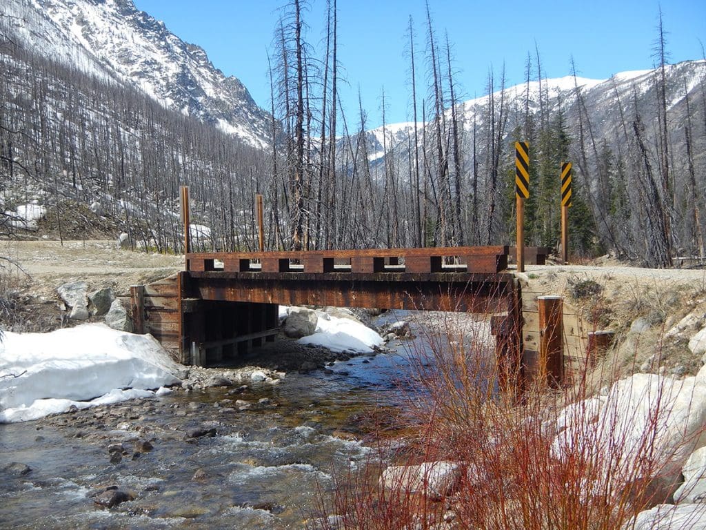
    Logan Simpson worked with the Custer Gallatin National Forest to develop a historic context and NRHP evaluation for the West Fork of Rock Creek (WFRC) Road in the Beartooth Ranger District, Montana. Since the end of the nineteenth century, the scenic, 15-mile-long WFRC Road has been a transportation corridor for homesteaders, recreationists, and entrepreneurs. The purpose of the project is to mitigate adverse effects to the WFRC Road and its associated historic properties from a reconstruction project. Logan Simpson reviewed records and other materials, including oral history transcripts, historic maps, and NRHP nominations, to revise an existing overview and context for the road. The revisions addressed the Forest Service’s comments on the draft; added descriptive data for historic resources present within the corridor; provided photographs and figures to supplement the text; and re-formatted the context to align with NPS guidelines for historic contexts. Logan Simpson also rewrote the statement of significance of the WFRC drainage and updated the existing nomination for the individually-eligible ca. 1906 Rock Creek Ranger Station, the only Forest Service administrative site known to have existed in the WFRC corridor.

  • Navajo Gallup Water Supply Project Programmatic Agreement Program Management

    Logan Simpson recently completed the fifth year as the  programmatic agreement program manager (PAPM) for the Navajo-Gallup Water Supply Project  (NGWSP) in northwest New Mexico and northeast Arizona. We are responsible for providing independent monitoring and review of BOR’s compliance with the NGWSP PA. Major tasks include assisting BOR with tribal consultation, report review, report distribution, and maintaining lines of NGWSP-related communication. Tribal consultation includes assisting members of 14 tribes with field visits to archaeological sites and traditional cultural properties, regularly updating tribes on NGWSP activities, and ensuring that tribes have opportunities to contribute to the decisions regarding the treatment of cultural resources. Logan Simpson has facilitated 15 PA workgroup meetings and has assisted BOR with review of cultural resources documentation for 21 construction reaches. In addition the Logan Simpson has assisted BOR with presentations to tribal councils and cultural advisory boards and with the development of an amendment to the PA drawing upon our experience drafting agreement documents for other agencies. Most recently, Logan Simpson successfully facilitated the development of a tribal monitoring program that will complement archaeological monitoring during project construction. We are currently drafting a “best practices” manual for cultural resources compliance and consultation for complex construction projects such as the NGWSP.  We were recently reselected and will continue our role as the PAPM for the next five years.

  • Dugway Proving Ground Air Force Use Areas Site Recording

    The US Army Dugway Proving Ground requested that Logan Simpson record sites left unrecorded by a previous consultant. We used the previous consultant’s preliminary data (more than 200 GPS points) to locate cultural resources and determine site boundaries. Three sites were defined in the Northern Area and four sites were recorded in the Southern Area. We also prepared National Register recommendations for each site. The Northern Area is covered by a large, extensive dune field. Dunes contain a variety of food resources, were seasonally occupied by prehistoric peoples for several millennia, and these repeat visits often result in dense, sprawling sites. One site—known as the Eleanor site—covered more than 220 acres and contained thousands of prehistoric artifacts associated with the Formative period. The Southern Area is on the playa left by the regression of Lake Bonneville. Several large sites associated with the Paleoarchaic period—the oldest known human occupations in the Americas—were recorded in this area. One of the Paleoarchaic sites, affectionately termed The Beast, covered 360 acres and contained more than 800 Stemmed projectile points. We also used our field-portable XRF spectrometer to source obsidian artifacts, which, because artifacts don’t need to be collected and can be sourced in the field, offered Dugway a value added service. The project presented several challenges, including working in varying environmental conditions; recording several large, unique sites; and coordinating safety and access with Dugway’s Range Control. However, our experience at Dugway and our experience documenting large, complex sites allowed us to plan for these complications and complete all work within schedule.

  • Vya B and C Juniper Treatment Projects Cultural Resources Inventory

    The BLM Surprise Field Office conducted the Vya B and C projects in Modoc County, California and Washoe County, Nevada. The project will reduce juniper densities resulting in less intense wildfires and higher quality habitat for sage-steppe obligates. Logan Simpson conducted two inventories, one in 2014 and one in 2015, and a total of 7,020 acres were inventoried. Fieldwork resulted in 169 sites. The majority of sites were associated with the prehistoric period and included large lithic scatters, quarry sites, and sites containing rock stacks or cairns. A high number of rock art sites were also recorded; many of these included dozens of panels, hundreds of images, and numerous types of designs and motifs. Several specialized methods were used to document and assess the rock art sites, such as detailed photography, mapping, and assessments of viewshed. All of the inventory areas were in remote, rugged areas and we practiced remote camping to ease travel time to and from the areas, used our ATVs where feasible, and staffed a right-sized crew to expedite fieldwork. We also followed a defined Safety Plan to insure that no safety incidents occurred.

  • Pictograph Cave National Register Evaluation and PXRF Sourcing

    The BLM Prineville District hired Logan Simpson to evaluate the Pictograph Cave site for the NRHP. The site is in south-central Oregon and includes prehistoric pictographs, or painted elements, and petroglyphs (incised images). The site was discovered in 1938 by well-known archaeologist Luther Cressman and has been revisited several times—though none of these resulted in an NRHP determination. Additional tasks included updating the site record, preparing a report, and making management recommendations. Logan Simpson owns a portable x-ray fluorescence (PXRF) analyzer, which is a unique asset, and as a value-added service we used PXRF to analyze the pictographs. We teamed with Dr. Bruce Kaiser—inventor of the Bruker PXRF system and renowned researcher in nuclear physics—to conduct the PXRF studies. PXRF determined the mineral composition of pigments; helped infer pigment preparation and application techniques; and identified the work of different artists and painting events. The analysis found that the pictographs were made with berry juice; previous studies have found that pictograph pigments are often made from minerals, such as red ochre, and the use of berries at the Pictograph Cave site is unexpected.

    Our use of innovative technology offered BLM an additional research avenue and added to the archaeological record of Oregon.

  • Duck Valley Architectural Documentation

    Logan Simpson’s historic preservation specialists completed architectural documentation on two buildings located on the Duck Valley Indian Reservation in Owyhee, Nevada. Both buildings, a former hospital and a power house, were constructed in 1937 following the unification of the Shoshone and Paiute Tribes at Duck Valley under the Indian Reorganization Act of 1934. Both the former hospital and power house are constructed of volcanic stone native to the Owyhee area and represent an important period of development in the history of the reservation. Architectural documentation was followed by NRHP eligibility recommendations for each building. Logan Simpson also conducted oral history interviews of two longtime Duck Valley residents to gain more information about each building. These interviews provided valuable material regarding the history of both the former hospital and power house and underscored each building’s significance to the history and development of the Duck Valley Reservation.

  • Hopi Tribe Keams Canyon Quarters Building 36 Historic American Building Survey Documentation

    On behalf of the BIA Western Regional Office, Division of Environmental Management, Logan Simpson completed Historic American Building Survey (HABS)-level documentation for Building No. 36 (H65-01-36). The building was formerly part of the Keams Canyon Boarding School located on the Hopi Indian Reservation in Keams Canyon, Arizona. Architectural documentation included recordation of building materials and construction techniques, as well as large-format black and while film and digital photography, site mapping, and photographic reproduction of floor plans. Documentation was in compliance with federal regulations for Level II HABS documentation submissions to the Library of Congress.

  • National Historic Trail Interpretive Assessments

    The BLM Wyoming State Office is developing conceptual guidelines to improve how BLM manages interpretive sites and overall visitor services along the California, Oregon, Mormon Pioneer, and Pony Express National Historic Trails (NHTs). Most NHT interpretive sites in Wyoming were developed in the 1970s and 1980s and are largely in a state of disrepair. Logan Simpson prepared site concept and interpretive sign plans for 28 BLM historic sites to assist in protecting cultural resources, improving site stewardship and motorized use, and user behavior with appropriate levels of public access. BLM Wyoming’s NHT visitor use and interpretive guidelines report will improve outdated facilities, accessibility, brand conformity, and interpretive effectiveness. The research and guidance on visitor profiles and outcomes, and shared goals with external partners will assist with visitor use planning. BLM Guidelines for the Quality Built Environment were implemented for the 28 sites, which in combination with an inventory and project record will streamline preparation of subsequent NEPA compliance.


    For the first time in the history of the National Trails System Act, a statewide and trail-wide Recreation Opportunity Spectrum (ROS) inventory characterizes the physical, social and operational components of Wyoming’s NHT visitor services. The ROS inventory of specific recreational setting characteristics and desired experiences is based on cultural resource sensitivity and public lands access and will inform subsequent resource management plans and NEPA analyses. An “idea book” was also prepared to highlight innovative interpretive methods not being utilized by BLM to inform detailed design of interpretive signage and digital mediums.

  • BLM Worland Field Office Travel Route Inventory

    Logan Simpson conducted route inventories of 3,429 miles and captured over 9,000 geotagged photos across 1,710,089 acres in the Worland Field Office in Wyoming. We used BLM’s GTLF standard in conjunction with a customized data dictionary. The inventory team maintained photos and track logs to document conditions and location of infrastructure such as campsites, signs, gates, unexpected trail terminations, etc. Inventory crews camped on BLM land during the inventory to avoid daily commuting, resulting in higher (inventoried) miles per day. This approach allowed the team to complete the project on budget and within the period of performance. Special consideration was given to the season in which inventory was conducted to ensure an accurate travel network was documented. Conducting the inventory around hunting season resulted in the documentation of routes that only have heavy use during that time of year.

  • Little Snake Route Evaluation, Travel Management Plan, and EA

    The BLM Little Snake Field Office route evaluation and travel management plan (TMP) is creating a new model for controversial transportation plans. Logan Simpson conducted evaluation, NEPA, and travel management planning tasks, including an EA, for 800 miles of roads, highways, and trails in the Hiawatha, Sand Wash, and Bears Ears travel planning areas in northwestern Colorado. The goal of the TMP is to create a travel network that is logical and sustainable, and also meets the increasingly diverse transportation, access, and recreational needs of the public. The EA analyzes the proposed plan and the alternatives that were considered during the planning process. Resources in the planning area include wildlife, cultural resources, grazing, energy and minerals, rights-of-way, paleontological resources, and recreation. We used Logan Simpson’s Travel Resource Analysis Model (TRAM) evaluation tool, which builds on the fundamental requirements set in the resource management plan to identify the benefits and risks associated with each route. TRAM allows NEPA data and guidance to be viewed in real time and creates an automatic administrative record of project details.


    We also used unconventional public involvement activities to engage stakeholders and cooperating agencies early in the planning process. We conducted public open houses inviting the public to engage early in the review of inventoried routes, evaluation criteria for route evaluation, identification of scoping issues, and review of proposed alternatives. We also used an online commenting tool allowing the public to comment on individual routes in addition to general comments on the travel system.


    Logan Simpson is following the streamlining guidelines contained in the Secretary of the Interior’s Executive Order 3355 as we develop the EA.