• Lake Powell Pipeline Biological Resource Survey

    Logan Simpson completed biological resources technical studies for the proposed 225-mile Lake Powell Pipeline. The project included the construction and operation of a buried water pipeline, water intake facility at Lake Powell, surface water storage reservoirs, hydro-electric generation facilities, and transmission lines. The pipeline corridor included federal, state, private, and tribal lands extending from Glen Canyon Dam, Arizona to Cedar City, Utah. Logan Simpson: completed 386 miles of field surveys documenting 16 special-status plant species occurrences of over 350,000 plants; mapped the distribution of 17 species of noxious/invasive weeds; recorded 306 plant taxa; and documented 3,443 polygons representing 556 vegetation associations on 25,000 acres. As alignments shifted, we assessed which rare plants potentially occur and adjusted survey schedules to match phenology of the target plants in target areas to aid in surveys and positive identification. A geospatial database of the vegetation survey results was developed to provide the basis for impact analysis of rare plants, determine mitigation actions, and develop an invasive/noxious species management plan.

  • Browns Canyon National Monument Resource Management Plan and EIS

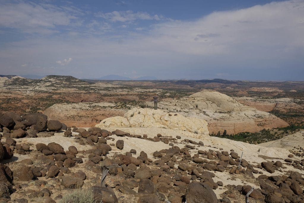
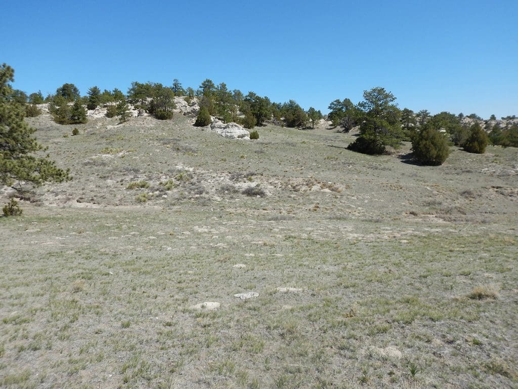
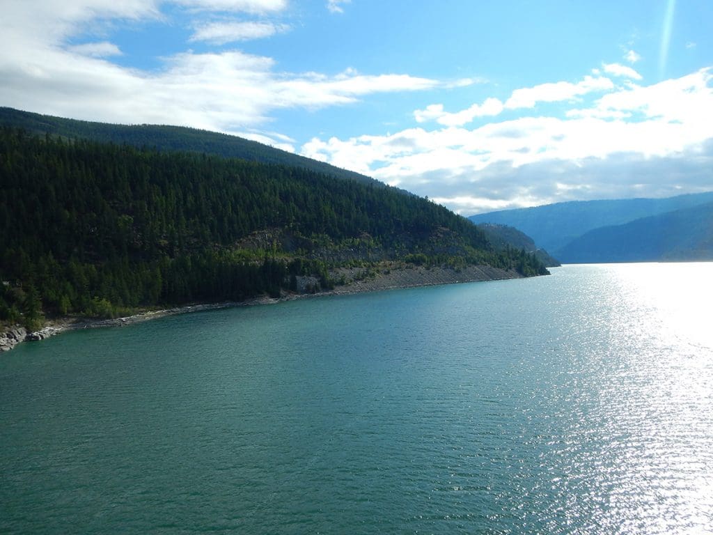
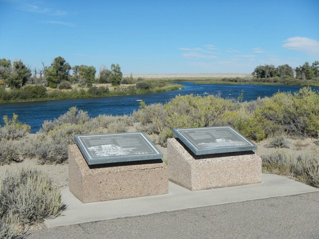
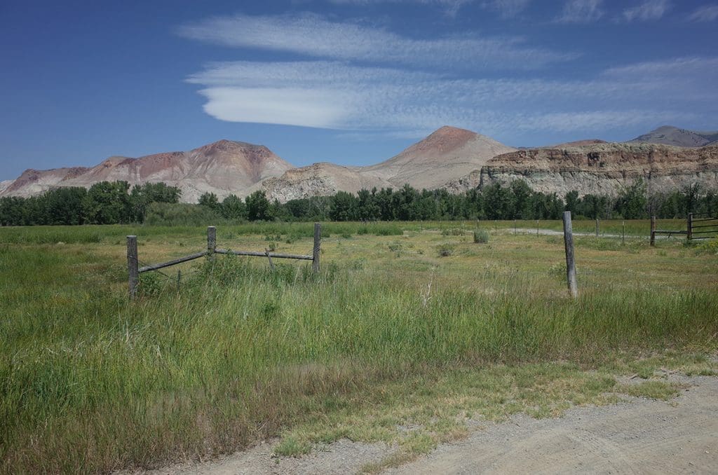
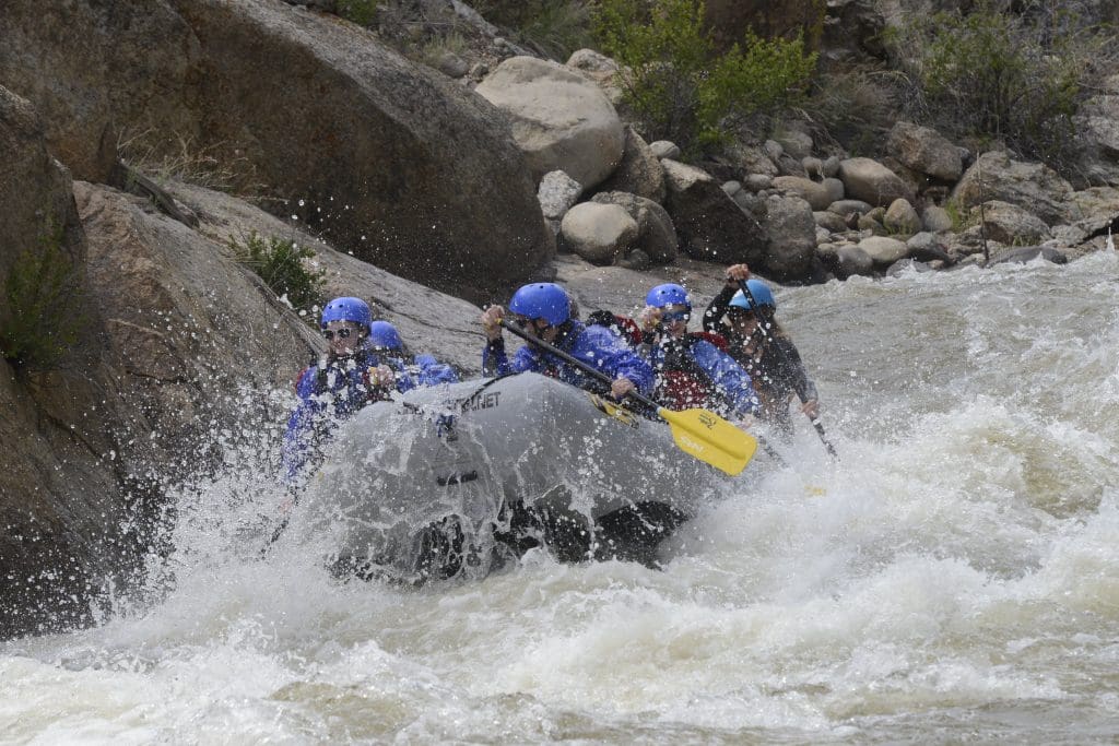
    Logan Simpson led preparation of the first-ever resource management plan (RMP) for the newly-created Browns Canyon National Monument in Colorado. This 21,604-acre monument is located along the upper Arkansas River and contains scenic and diverse natural resources. The monument is jointly managed by BLM and USFS and includes one of the most heavily utilized commercial boating areas in the nation. The RMP focuses on protection of resources, continued public use and enjoyment, and continuation of historic uses, such as livestock grazing.

    Logan Simpson also prepared the associated EIS for the BLM and USFS. The EIS was completed in just 434 days from the Notice of Intent to the publication of the Record of Decision in July 2020—more than a year ahead of the contracted schedule.  Logan Simpson’s planners employed multiple strategies to help keep the project moving, such as crosswalking the agencies’ vocabularies and processes. This small but important step helped improve the Interdisciplinary Team’s respect and understanding for each agency’s guidelines and reduced schedule delays and do-overs.

  • Community Wildfire Protection Plans

     The wildland urban interface (WUI) is the area where homes are built near or among lands prone to wildland fire. These areas have become more popular for homeowners for their privacy, natural beauty, recreational opportunities and affordable living. As a result, rural fire districts are more often having to fight fire and protect homes and property within these WUI areas. Logan Simpson developed the first two CWPPs in Arizona for the at-risk communities of the Apache-Sitgreaves National Forest that complied with Title I of the Healthy Forests Restoration Act of 2003 (HFRA). We facilitated the collaboration among Federal, state, and local partners as well as Native American tribes to developed these two CWPPs and established priorities to reduce the risks to communities and surrounding lands. Subsequent to these first two CWPPs, Logan Simpson developed 20 CWPPs, analyzed over 31 million acres, and gathered input from over 300 communities across multiple states.

  • Four Forests Restoration Initiative (4FRI) Facilitation

    The Four Forest Restoration Initiative is a collaborative effort more than 20 years in the making. 4FRI is the flagship of the Forest Service’s national Collaborative Forest Landscape Restoration Program which sought to achieve the collaborative, science-based ecosystem restoration on unhealthy forest landscapes.  This project is considered one of the most massive restoration projects in the nation. Stakeholder collaboration and consensus was central, as the values of restoration are complex. Stakeholders were a broad cross-section of more than 100 organizations, including federal, state, and local government, timber industry, preservation, and environmental interest groups, and citizens. The collaborative had often been divided deeply on specific issues and struggled to achieve consensus. Within four years, the collaborative turned over five different facilitators before turning to Logan Simpson. From 2012 to 2015, Logan Simpson guided the group through several complex challenges. Where possible, we brought electronic polling and modern collaborative planning tools into the 4FRI mix. The group’s success with Logan Simpson included revised decision rules (unanimously adopted); revision of the behavior-related ground rules of the Charter; revisioning/strategic planning each year; consensus comments on a draft EIS for the first analysis area; and successful collaborative leadership leading to broad-based support for the final EIS, which has moved to implementation without litigation. Logan Simpson managed and facilitated the collaborative with steering committee calls, facilitated meetings, problem-solving and conflict resolution.

  • NPS Transportation Resource Stewardship Protection Tool

    Logan Simpson is beginning Phase IV of this project, which provides a web-based decision-support system to allow NPS staff to manage natural resources within national parks. The tool allows users to aggregate and review natural resource data from multiple parks so trends can be identified. During Phase II, Logan Simpson piloted the program in ten parks in the Southeast Region. During Phase III, we improved the tool based on information gathered from interviews conducted with NPS technical specialists. The pilot testing for this phase was conducted in the Alaska Region and included nine national parks, two national forests, three national wildlife refuges, and BLM’s Eastern Recreational Management Area. In Phase IV, Logan Simpson will update the tool; update/develop support resources; and pilot the tool in the Intermountain Region.

  • Grand Staircase Escalante National Monument Visual Resource Inventory

    Logan Simpson is currently working on the final phase of the visual resource inventory (VRI) for the Grand Staircase Escalante National Monument (GSENM), located in south-central Utah. This VRI spans a study area of just less than two million acres, including all public lands with the prior GSENM boundary, as well as almost 40,000 acres of the Kanab Field Office that are located north of the monument’s boundary. The study area includes much of the Escalante River and Paria River watershed, segments of Scenic Byway 12 (Utah’s only All-American Road) and many miles of state scenic byways and back ways. It also encompasses 16 wilderness study areas, 252 miles of suitable wild and scenic river segments, and significant archaeological and historic sites, including a segment of the Old Spanish National Historic Trail, Dance Hall Rock National Historic Site, and the Hole in the Rock State Historic Trail.


  • Visual Resource Inventory of National Historic Trail Segments

    Logan Simpson provided a field inventory program for the Wyoming Military Department that assessed the trail segment and viewshed conditions of approximately 26 miles of the California, Oregon, Mormon Pioneer, and Pony Express National Historic Trails (NHTs) within the administrative bounds of Camp Guernsey, located in eastern Wyoming. The results of this assessment were then carried into NRHP eligibility recommendations for each trail segment. The site condition assessments included detailed in-field archaeological documentation of the disturbances to the trails. Archaeological documentation included inventory, measurements, photographs, and GPS-based mapping; this new data was compared to previously documented trail segments to determine the current condition of the trail sites. In addition, Logan Simpson prepared an archaeological report documenting the history, locations, and current integrity of the trail segments, as well as OAHP site forms. Logan Simpson provided a robust GIS data set of inventory components as well as supporting documentation associated with visual resources, NHT condition assessments by segment, and NRHP eligibility recommendations.

  • BLM Missoula Field Office Visual Resource Inventory

    Logan Simpson completed a visual resource inventory (VRI) for the BLM’s Missoula Field Office encompassing the highly scenic landscapes of western Montana. This inventory area covers nearly 14 million acres, including the Bitterroot Valley and Mountains, Flathead Lake, and Bob Marshall and Scape Goat Wildernesses. The inventory also abuts the world-renowned scenery of Glacier National Park, and includes viewsheds shared by the park. The inventory data will be considered as baseline information as the field office embarks on the development of its resource management plan. Research and public outreach for this project revealed numerous planning documents aimed at protecting scenery and scenic viewsheds—reinforcing the importance that users place on the area’s visual resources. This information was taken into consideration during visual sensitivity ratings, and resulted in well-informed and accurate delineations of differing sensitivities within the field office. Based on the varying topographic features, common presence of water, and variety of vegetation and colors, this inventory has revealed the largest percentage of Class A scenery of any of the VRIs we have completed to date. Vertical mountain ranges, scenic lowlands, large lakes, clear flowing water, and lush vegetation lend to the distinct character of these landscapes, much of which appears as it did when original inhabitants, explorers, and early settlers crossed these lands. The National Historic Trail (NHT) visibility analyses for the Lewis and Clark NHT and Nez Perce NHT that we completed provided additional information for consideration in management of the historic travel that add to the history of the area.

  • National Historic Trail Interpretive Assessments

    The BLM Wyoming State Office is developing conceptual guidelines to improve how BLM manages interpretive sites and overall visitor services along the California, Oregon, Mormon Pioneer, and Pony Express National Historic Trails (NHTs). Most NHT interpretive sites in Wyoming were developed in the 1970s and 1980s and are largely in a state of disrepair. Logan Simpson prepared site concept and interpretive sign plans for 28 BLM historic sites to assist in protecting cultural resources, improving site stewardship and motorized use, and user behavior with appropriate levels of public access. BLM Wyoming’s NHT visitor use and interpretive guidelines report will improve outdated facilities, accessibility, brand conformity, and interpretive effectiveness. The research and guidance on visitor profiles and outcomes, and shared goals with external partners will assist with visitor use planning. BLM Guidelines for the Quality Built Environment were implemented for the 28 sites, which in combination with an inventory and project record will streamline preparation of subsequent NEPA compliance.


    For the first time in the history of the National Trails System Act, a statewide and trail-wide Recreation Opportunity Spectrum (ROS) inventory characterizes the physical, social and operational components of Wyoming’s NHT visitor services. The ROS inventory of specific recreational setting characteristics and desired experiences is based on cultural resource sensitivity and public lands access and will inform subsequent resource management plans and NEPA analyses. An “idea book” was also prepared to highlight innovative interpretive methods not being utilized by BLM to inform detailed design of interpretive signage and digital mediums.

  • Arkansas Headwaters Recreation Area Management Plan Revision and EA

    Logan Simpson worked with the BLM (NEPA lead); Colorado Parks and Wildlife (management plan lead); and the US Forest Service (land manager) to update to the management plan and EA for the 150 miles Arkansas Headwaters Recreation Area (AHRA).  The AHRA is one of the nation’s most popular whitewater boating rivers and receives the highest level of commercial boating of any river in the nation. With 700,000 visitors annually, the AHRA is also popular for camping, wildlife watching, gold panning, and numerous other river-related recreation activities including its Gold Medal Trout Fishery. The challenge for the AHRA is to satisfy seemingly infinite recreational demands while at the same time maintaining both the environmental quality and the quality of visitor experiences along the river. The issue-driven management plan and EA addresses a wide array of topics, with a focus on carrying capacity, potential user conflicts, special activity and special use permitting, travel management updates for key areas, the need for new or improved facilities, and improved access and resource conservation. Logan Simpson led three rounds of public outreach to help guide the AHRA partnership in four different cities across the Front Range and in the project vicinity.