• Oak Ridge State Wildlife Area Cultural Survey

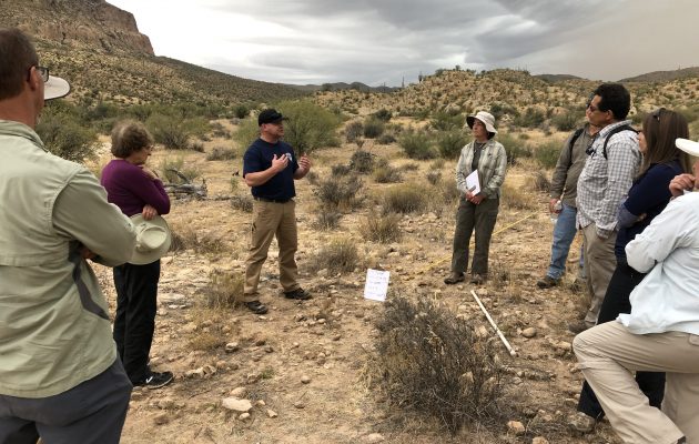
    Colorado Parks & Wildlife contracted with Logan Simpson to conduct a Class III cultural resources inventories for vegetation thinning to support wildlife management activities at the Oak Ridge State Wildlife Area. The 1,535 acre project area includes 1,015 acres administered by the State of Colorado and 520 acres by the Bureau of Land Management White River Field Office in Rio Blanco County, Colorado. Services may include: prescribed burning of mountain scrub land and aspen habitats; mechanical mulching/thinning of mature mountain scrubs; clearcutting decadent aspen stands to promote regeneration of young aspen trees; interceding diverse custom seed mixes to provide diverse wildlife forage; prescribed burning as follow-up maintenance; and aerial herbicide applications to control weeds and scrub regrowth. The project is considered a federal undertaking subject to compliance with Section 106 of the National Historic Preservation Act. The inventory resulted in the recordation and evaluation of 5 prehistoric and historic sites and 7 prehistoric isolated finds.

  • Ketchum Historic Preservation Plan Update

    Logan Simpson worked diligently with City Staff to expedite drafting of an interim historic preservation ordinance to enact baseline regulations and protections while a permanent ordinance with incentives and design guidelines is developed. The interim ordinance was developed with the input of many community stakeholders – including historians, developers, architects, real estate agents, and members of the community – through online surveys and small group meetings. Logan Simpson is currently working with the City of Ketchum to develop a permanent historic preservation ordinance, historic design guidelines, and a preservation handbook with preservation incentives.

  • Block 32 Utilities Administration Building

    Located in downtown Fort Collins, Block 32 was an under-utilized parcel with potential to become a vibrant civic campus and public space. Logan Simpson worked with the architect (RNL Design) to develop programming, development concepts, and master planning for the parcel. This vision for the Civic Center is built around sustainable best practices and quality urban design standards. The design team embraced the buildings utilities’ services theme and aspired towards Net Zero classification, coordinating use of solar energy, high efficiency building materials, and low impact design planting strategies. The design incorporates the preservation of a small historic building on site with elements such as rain gardens, a living wall, and utility-themed public art formed into concrete entry walls. Construction on the two-acre Utilities Administration Building site was completed in late 2016. In June 2017, the site was awarded LEEDv4 New Construction (NC) Platinum status, the first V4 NC Platinum project in Colorado, and only the 3rd awarded in the U.S.

  • Montrose City-Wide Historic Resources Survey Plan

    Logan Simpson recently completed a city-wide historic resources survey plan for the City of Montrose, Colorado. The project was funded by a certified local government (CLG) grant provided by the Colorado State Historic Fund and established baseline data and priorities to help guide the wise use of the community’s resources. The creation of this historic resources survey plan overlaps with Montrose’s ongoing efforts to update its 2008 Comprehensive Plan, which will act as the official guide for the city’s strategic planning up to the year 2040. Logan Simpson’s survey plan includes evaluation of existing data, historic context development, limited reconnaissance level survey, descriptions of significant resources and property types, and public outreach. Through these efforts, Logan Simpson identified multiple historic resources for individual and district designations, documented the presence of significant landscapes, streetscapes, viewsheds, and historic and vintage signage, and identified over 25 different architectural styles and forms within City limits. The report also includes a discussion of goals, objectives, and a list of historic preservation priorities ranked in order of importance to be implemented over the next 15 years.

  • National Historic and Scenic Trails Methodology, Field Guide, and Training

    Logan Simpson’s landscape architects, archaeologists, historic preservationists, biologists, visual resource specialists, and recreation specialists recently worked with the BLM to develop a first-of-its-kind methodology to help inventory, assess, and monitor National Scenic and Historic Trails (NSHTs). Since National Trails often cross multiple administrative boundaries, the BLM purposefully designed the methodology so it could be used by all agencies and organizations who share management responsibilities. This integrated approach provides federal, state, and local agencies and trail organizations with a common framework as they inventory, assess, and monitor each trail’s resources, qualities, values, settings and uses.

    The National Trails Methodology considers four landscape elements―natural, scenic, historic and cultural, and recreation―and how they work together to define the nature, purposes, and uses of a trail. An interdisciplinary team made up of agency decision-makers, technical professionals in each resource area, and members of trail organizations and volunteer groups implements the methodology. Together, they determine how to study the trail—from the locations from which inventory will be conducted to how data will be collected and analyzed, and eventually to how resources will be monitored. Cross-agency participation is encouraged when trails cross jurisdictional boundaries.

    A companion Field Guide and training curriculum provide the step-by-step guidance needed to carry out the methodology. Both the Field Guide and training emphasize the use of existing programs, skill sets, and data standards whenever possible with simple checklists and a standardized monitoring form to ensure consistency across agencies. BLM anticipates that the NSHT Methodology, Field Guide, and Training will be rolled out in early 2020.

  • Custer Gallatin National Forest Historic Overview, West Fork Rock Creek Road

    Logan Simpson worked with the Custer Gallatin National Forest to develop a historic context and NRHP evaluation for the West Fork of Rock Creek (WFRC) Road in the Beartooth Ranger District, Montana. Since the end of the nineteenth century, the scenic, 15-mile-long WFRC Road has been a transportation corridor for homesteaders, recreationists, and entrepreneurs. The purpose of the project is to mitigate adverse effects to the WFRC Road and its associated historic properties from a reconstruction project. Logan Simpson reviewed records and other materials, including oral history transcripts, historic maps, and NRHP nominations, to revise an existing overview and context for the road. The revisions addressed the Forest Service’s comments on the draft; added descriptive data for historic resources present within the corridor; provided photographs and figures to supplement the text; and re-formatted the context to align with NPS guidelines for historic contexts. Logan Simpson also rewrote the statement of significance of the WFRC drainage and updated the existing nomination for the individually-eligible ca. 1906 Rock Creek Ranger Station, the only Forest Service administrative site known to have existed in the WFRC corridor.

  • Pictograph Cave National Register Evaluation and PXRF Sourcing

    The BLM Prineville District hired Logan Simpson to evaluate the Pictograph Cave site for the NRHP. The site is in south-central Oregon and includes prehistoric pictographs, or painted elements, and petroglyphs (incised images). The site was discovered in 1938 by well-known archaeologist Luther Cressman and has been revisited several times—though none of these resulted in an NRHP determination. Additional tasks included updating the site record, preparing a report, and making management recommendations. Logan Simpson owns a portable x-ray fluorescence (PXRF) analyzer, which is a unique asset, and as a value-added service we used PXRF to analyze the pictographs. We teamed with Dr. Bruce Kaiser—inventor of the Bruker PXRF system and renowned researcher in nuclear physics—to conduct the PXRF studies. PXRF determined the mineral composition of pigments; helped infer pigment preparation and application techniques; and identified the work of different artists and painting events. The analysis found that the pictographs were made with berry juice; previous studies have found that pictograph pigments are often made from minerals, such as red ochre, and the use of berries at the Pictograph Cave site is unexpected.

    Our use of innovative technology offered BLM an additional research avenue and added to the archaeological record of Oregon.

  • Duck Valley Architectural Documentation

    Logan Simpson’s historic preservation specialists completed architectural documentation on two buildings located on the Duck Valley Indian Reservation in Owyhee, Nevada. Both buildings, a former hospital and a power house, were constructed in 1937 following the unification of the Shoshone and Paiute Tribes at Duck Valley under the Indian Reorganization Act of 1934. Both the former hospital and power house are constructed of volcanic stone native to the Owyhee area and represent an important period of development in the history of the reservation. Architectural documentation was followed by NRHP eligibility recommendations for each building. Logan Simpson also conducted oral history interviews of two longtime Duck Valley residents to gain more information about each building. These interviews provided valuable material regarding the history of both the former hospital and power house and underscored each building’s significance to the history and development of the Duck Valley Reservation.

  • Hopi Tribe Keams Canyon Quarters Building 36 Historic American Building Survey Documentation

    On behalf of the BIA Western Regional Office, Division of Environmental Management, Logan Simpson completed Historic American Building Survey (HABS)-level documentation for Building No. 36 (H65-01-36). The building was formerly part of the Keams Canyon Boarding School located on the Hopi Indian Reservation in Keams Canyon, Arizona. Architectural documentation included recordation of building materials and construction techniques, as well as large-format black and while film and digital photography, site mapping, and photographic reproduction of floor plans. Documentation was in compliance with federal regulations for Level II HABS documentation submissions to the Library of Congress.

  • City of Cottonwood Historic Resources Inventory and Planning

    At the request of the City of Cottonwood, Logan Simpson performed the first phase of a two-phase historic property inventory and preliminary NRHP eligibility assessment. Phase I included a historic property survey of residential neighborhoods and districts located within the municipal boundaries of the City in an effort to identify those resources that are potentially eligible for inclusion in the NRHP. Phase I results will be incorporated into the City’s municipal planning, land-use, and development processes. Phase II will begin in the winter of 2019, and will include amending the existing Cottonwood NRHP Commercial District boundaries, and updating associated design guidelines for properties located within this NRHP district.