• Standin’ on the Corner Park, Performance Plaza, and Downtown Streetscape

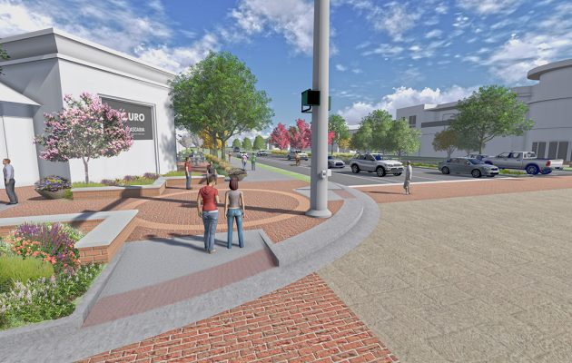
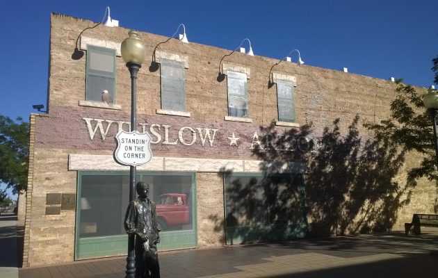
    Thirty years after Interstate 40 bypassed historic Route 66 through Winslow, Arizona, the town took on a project to restore the historic character of its downtown core, which is largely defined by its relationship to the roadway. Improvements included Standin’ on the Corner Park, named for the Eagles song “Take it Easy,” which includes the lyrics “I’m standin’ on the corner in Winslow, Arizona/And such a fine sight to see/It’s a girl, my lord, in a flatbed Ford/Slowin’ down to take a look at me.” Under a Transportation Enhancement grant, Logan Simpson designed the park, an ADA accessible performance stage using historic car front ends as for lighting, a stage cover, and provided theming and streetscape design for the sidewalk trellis, perimeter sidewalk areas, including landscape, accent paving, and street furnishings.

  • Our Big Sky Community Vision & Strategy

    Logan Simpson is working with the community of Big Sky, Montana to develop a cohesive vision and implementation strategy for future development, capital improvement projects, and strategic investments. Big Sky finds itself at an intersection–it is transitioning from a resort to a community. Logan Simpson is tasked to answer the following question: “What will Big Sky look like in 10 years?”

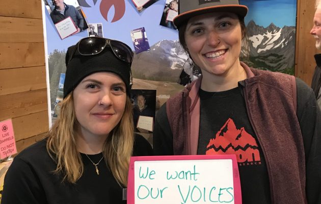
    The plan’s foundation identified and articulated the vision and goals that emerged from a robust public outreach process that represented Big Sky as a whole. Stakeholders demonstrated their support and a commitment early in the planning process; therefore, Logan Simpson focused on encouraging engagement from those not already involved–the locals. It was clear a hands-on approach was needed since many were hesitant to participate because they have worked in the community for only a short time, were too busy to participate, or did not want to disrupt their employment status. By offering one-on-one interviews (which broke our records for participation), our goal was to show the local workforce and permanent residents that they represent and reinforce the culture of Big Sky, and that their input truly does matter.

    We learned everyone comes from somewhere else in Big Sky—and have pride in choosing this great place. Likewise, everyone cares deeply about its future. Key issues identified during the initial outreach include infrastructure, road improvements, attainable housing, community gathering areas, and protection of the rivers. It was rewarding to learn that the values of all–the locals, landowners, developers, community leaders, and elected officials–are aligned by the desire to grow environmentally, socially, and economically. The plan will impact interagency collaboration and refocus efforts to address current issues and future opportunities. View the plan here.

  • National Historic and Scenic Trails Methodology, Field Guide, and Training

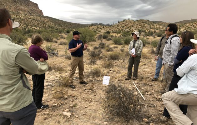
    Logan Simpson’s landscape architects, archaeologists, historic preservationists, biologists, visual resource specialists, and recreation specialists recently worked with the BLM to develop a first-of-its-kind methodology to help inventory, assess, and monitor National Scenic and Historic Trails (NSHTs). Since National Trails often cross multiple administrative boundaries, the BLM purposefully designed the methodology so it could be used by all agencies and organizations who share management responsibilities. This integrated approach provides federal, state, and local agencies and trail organizations with a common framework as they inventory, assess, and monitor each trail’s resources, qualities, values, settings and uses.

    The National Trails Methodology considers four landscape elements―natural, scenic, historic and cultural, and recreation―and how they work together to define the nature, purposes, and uses of a trail. An interdisciplinary team made up of agency decision-makers, technical professionals in each resource area, and members of trail organizations and volunteer groups implements the methodology. Together, they determine how to study the trail—from the locations from which inventory will be conducted to how data will be collected and analyzed, and eventually to how resources will be monitored. Cross-agency participation is encouraged when trails cross jurisdictional boundaries.

    A companion Field Guide and training curriculum provide the step-by-step guidance needed to carry out the methodology. Both the Field Guide and training emphasize the use of existing programs, skill sets, and data standards whenever possible with simple checklists and a standardized monitoring form to ensure consistency across agencies. BLM anticipates that the NSHT Methodology, Field Guide, and Training will be rolled out in early 2020.

  • Greater Phoenix Metro Green Infrastructure/LID Handbook

    Low impact development (LID), or sustainable stormwater management, is a green infrastructure (GI) technique practiced widely in the US outside the Southwest. This landscape-based technique can help reduce runoff and stormwater flows in existing conveyance systems, reducing nonpoint source pollutant loads and improving conformance with first-flush requirements. LID reduces stormwater peak flows and volumes, helping mitigating flood hazards. LID can also conserve stormwater, allowing it to be used as a supplemental landscape irrigation source that can help mitigate the heat-island effect and improve quality of life by providing vegetated spaces and shade.

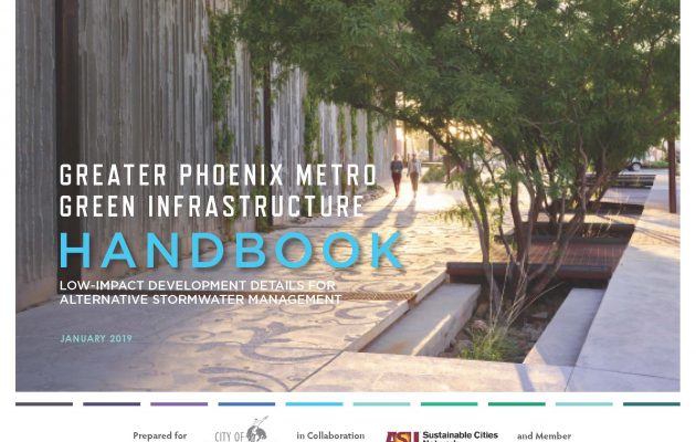
    In Arizona, LID is routinely practiced in Pima County. In recent years, Arizona State University’s Sustainable Cities Network (SCN) has fostered dialogue between Phoenix-area communities and agencies about sustainability, including how GI techniques like LID can be more widely implemented. The result was the Greater Phoenix Metro Green Infrastructure Handbook, which provides 10 LID-based technical standardized details and specifications (TSDSs) in Maricopa Association of Governments format. The 10 details were chosen by the SCN core team (cities of Scottsdale and Phoenix and the Flood Control District of Maricopa County), with input from other local communities.

    Data from more than 4,700 Pima County rainfall events and 319 Maricopa County rain gauges was analyzed to establish storm events where LID techniques can optimally mitigate pollution and flooding. The landscape architect conducted research into the geology and soils of the Phoenix area and developed plant palettes and planting concepts that support the LID approach. The landscape architect also worked closely with the engineer to develop TSDS for each LID feature and provided graphic design.

    The Handbook helps agencies meet water-quality regulations and sustainable design policies. It is the only document available that contains guidance and specific techniques for implementing LID treatments in the Greater Phoenix Metropolitan Area’s unique environment.

  • ASU Greek Village

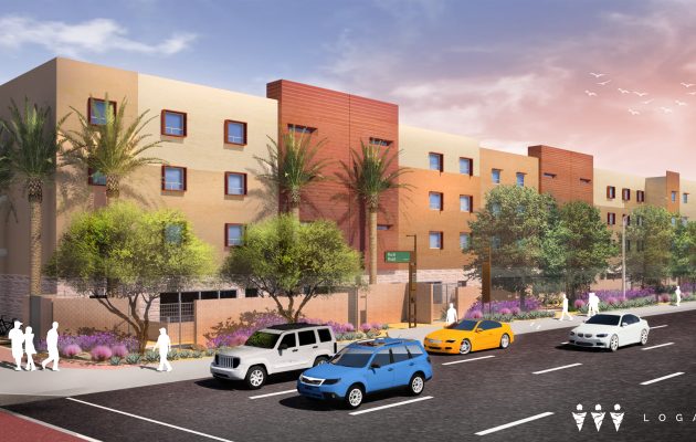
    Through a public-private partnership (P3), Arizona State University and American Campus Communities developed the $72 million ASU Greek Village student housing development on approximately 4.5 acres near the ASU campus. Logan Simpson designed the landscape for the 4-story, 240,000 s.f. residential housing/community center, which includes first-floor commercial development. Design elements include an entry plaza, patios, courtyards, monument and wayfinding signage, site furnishings, and landscaping and irrigation. Design aesthetics integrate a curvilinear paving pattern that connects indoor and outdoor spaces and harmonizes the community center with the residential housing. The site/landscape design responds to ASU’s Sustainable Design Guidelines and meets USGBC LEED – Building Design and Construction Development (LEED-BD+C)’s “Silver” rating guidelines.

  • Lincoln Corridor Plan

    Logan Simpson developed a vision plan for the Lincoln Avenue corridor extending from Old Town Fort Collins, Colorado to Lemay Avenue. The area contains a rich, eclectic mix of industry, breweries, historic neighborhoods, access to the Poudre River, open space, and regional trail systems. Woodward Governor recently chose the corridor for their new 6,000-employee world headquarters, in part because Lincoln Avenue would consist of a unique street design.

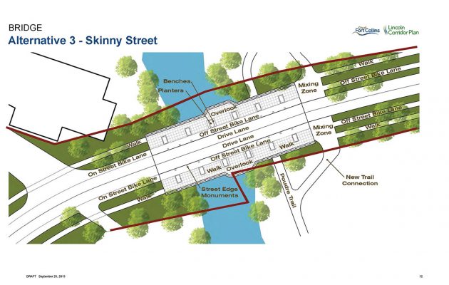
    As an emerging district adjacent to Old Town, Lincoln is envisioned as one of the next great places in Fort Collins. The Lincoln Corridor Plan provided specific recommendations on extensive street and bridge enhancements; incorporates best practices for street design including bioswales and permeable pavements; provides multimodal access; includes pedestrian amenities and gathering areas; establishes a cohesive identity for the corridor; recommends implementation strategies for funding and phasing; and prioritizes improvement projects.

    The vibrant street design sets the stage for a mix of small- and large-scale development. Neighboring residents and businesses provided extensive input on the vision through multiple online surveys, project webpage, bilingual project materials, a series of informational events such as barbecues, highly interactive workshops, attendance at local fairs and events, and corridor walks with residents, business owners, and other stakeholders.

  • Erie Parkway Corridor Study

    Logan Simpson helped develop a vision plan and streetscape design guidelines for the six-mile Erie Parkway corridor in Erie, Colorado. The area contains a diverse mixture of districts including downtown, existing and proposed residential areas, community and regional commercial areas, and a crossing of the Coal Creek open space and regional trail.

    The corridor plan is meant to identify—and eventually implement—multimodal transportation and streetscape improvements to enhance mobility, safety, and aesthetics along the corridor. The streetscape design was tailored for each character district, which provides variety while maintaining consistency between the elements and reinforcing and enhancing Erie’s small town identity.

  • Fruita Downtown Streetscape Improvements

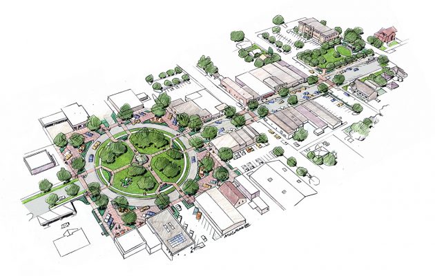
    Logan Simpson developed design enhancements to the City of Fruita, Colorado’s historic downtown core. The enhancements support business growth, will spur infill and redevelopment, and support the continued growth of festivals and events that are important economic stimuli for the community. The town is at the northern gateway to Colorado National Monument, and is well known for its scenic mountain-biking trails, Dinosaur Museum, and annual “Mike the Headless Chicken” and “Fat Tire” festivals. The Logan Simpson team prepared a master plan for Civic Center Memorial Park, which anchors the east end of the historic downtown, and hosts up to 25 concerts and community events during the year. We also developed plans for downtown core streetscapes, which accommodate year-round circulation and activities, as well as closures for major festivals. In the center of downtown is Park Square, which is currently dominated by cars and expansive asphalt paving associated with a large roundabout that surrounds Circle Park. The plan recommends widening the sidewalks around the square to 16 feet, and creating “woonerfs,” or living streets, in the corners that have landscaping and new pedestrian use areas that can accommodate buskers, vendors, food carts, and other temporary uses.

  • Big Thompson River Restoration Master Plan

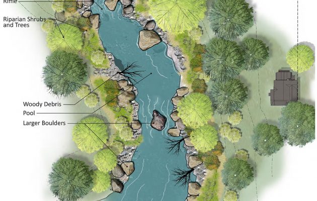
    Logan Simpson developed a post-flood river restoration master plan along an 80-mile corridor. The plan was designed to improve the flood resilience of infrastructure and to restore the river corridor after the massive destruction caused by the flooding of September 2013. Logan Simpson led an extensive stakeholder and multiagency engagement program, and focused on small group discussions using large-format maps of the affected area, website information, interagency meetings, elected and appointed official briefings, and on online map commenting tool called sMap. The lead engineering firm conducted geomorphic and flood risk assessments; ecological habitat assessments; reach prioritization; and developed recommendations that Logan Simpson illustrated in prototypical plans and sections. Logan Simpson went on to prepare “A Bigger Vision for the Big T,” a restoration and conservation plan for restoring and enhancing public recreational opportunities and conserving lands along the river corridor. The plan was designed to prioritize strategic investment, coordinate funding strategies, and facilitate unified decision-making among stakeholders.

  • Mehaffey Park

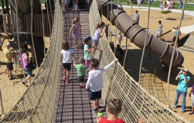
    This 69-acre community park is the City of Loveland, Colorado’s premier park for residents in the western part of the city. Logan Simpson developed a master plan and construction documents for the site, which includes a disc golf course, multipurpose fields, natural restored landscapes and drainages, tennis and basketball courts, skate park, dog park, an arboretum, fruit orchards, unique adventure play area, signature bridge, paved and soft surface trails, raw water irrigation and detention pond, picnic lawn and picnic shelters. Located on the route of the Overland Trail, references to this historic route are expressed in the design of site elements, and through art pieces and are sited throughout the park. We also designed a 0.25-mile of streetscape and road improvements near the park, as well as park access roads. We held public workshops in order to meet City standards and maintenance requirements, while respecting adjacency to residential development. The master plan process included programming/visioning sessions with City staff, several workshops, collaboration with a local artist, and a public survey of community preferences. A 3-D SketchUp model was also extremely valuable in showing neighbors what they would see from their residences.